Your history. Your inbox.
7 uniquely curated newsletters to choose from.


“When we come out here, my stress level goes way down. Way down,” cottage owner Angela emphasizes, as children’s laughter echoes in the background.
They are at their vacation home near Lac du Bonnet in eastern Manitoba, and the children are doing what kids should be able to do — just being kids.
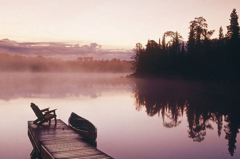
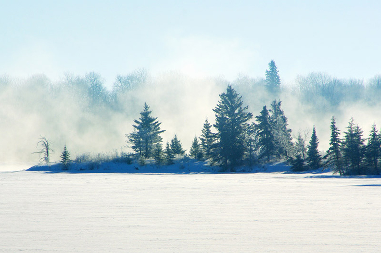
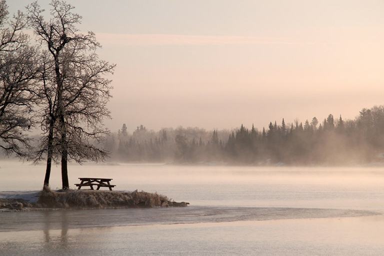
Lac du Bonnet has been cottage country since the beginning of the last century. Today’s retreats range from modest cabins to million-dollar chalets that dot the shores of the Winnipeg River.
This is the same river upon which Pierre Gaultier de Varennes de La Vérendrye travelled in the spring of 1733. The French voyageur named a wide section of the river Lac du Bonnet because its shape reminded him of a bonnet.
Evidence of human presence dates back at least eight thousand years. The Cree met La Vérendrye when he first arrived, but by 1800 they had moved on and the Anishinabe (Ojibwa) had arrived in the area from Lake Superior.
Spending an afternoon on a powerboat, we marvel at the strength and skill the voyageurs must have had in order to navigate these waters. It was a well-travelled fur trade route until the Montreal-based North West Company merged with the Hudson’s Bay Company in 1821.
We learn of Colonel Wolseley’s troops canoeing the river to suppress Louis Riel’s resistance and how the great canoe era ended around 1870.
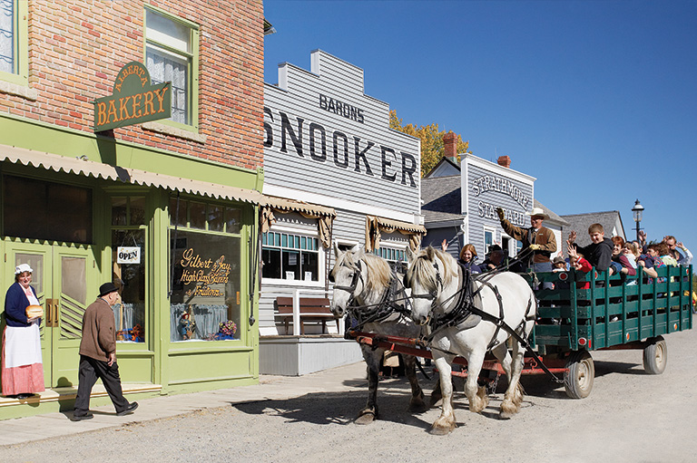
The next morning we spend our time in the town visiting cozy shops, including a bakery filled with the delightful aroma of freshly baked bread. A bustling Saturday morning market offers fresh vegetables, honey, and local crafts.
“[La Vérendrye] named a wide section of the river Lac du Bonnet because its shape reminded him of a bonnet.”
Then we leave Lac du Bonnet and drive to the old town of Pinawa. Heading along Highway 211E, we see a sign reading “Atomic Energy of Canada Limited.”
We travel through dense spruce, turning north on Provincial Road 520 –– a gravel road leading to the original town of Pinawa and the old Pinawa Dam.
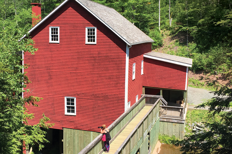
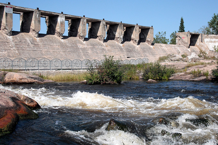
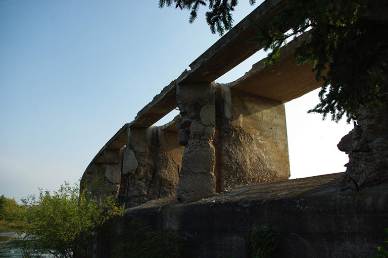
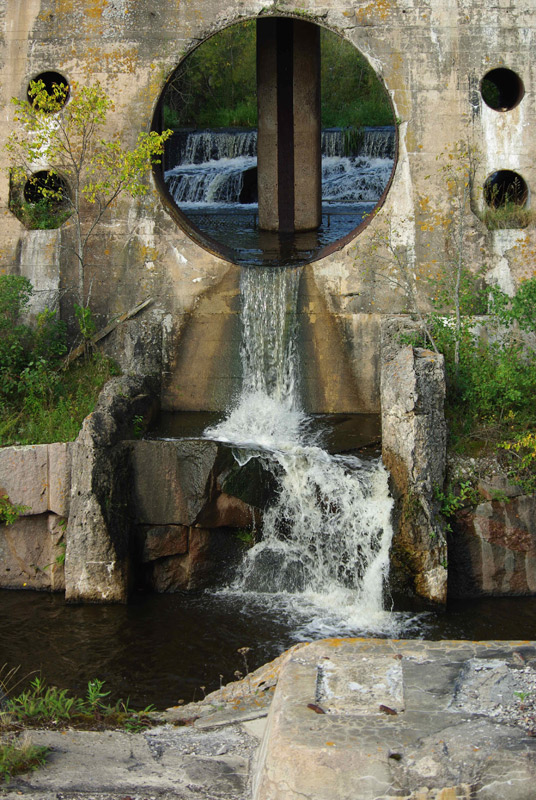
In 1906, Manitoba’s first hydroelectric generating station was built here by the Winnipeg Electric Company to meet the city’s booming energy demands. A large concrete structure was built to harness the Winnipeg River.
Although the site stopped producing power in 1951, and the settlement has since been abandoned, the ruins of the dam have survived and now form part of Pinawa Dam Provincial Park. People enjoy picnicking, hiking the self-guiding trails, and sunbathing on the rocks.
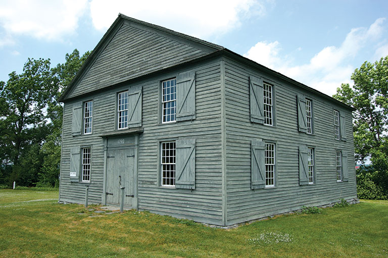
The old townsite is well signposted. The spots where the homes, community garden, town hall, and school were located are all marked.
On the move again, we arrive at the new Pinawa townsite. AECL started it as a company town in 1963.
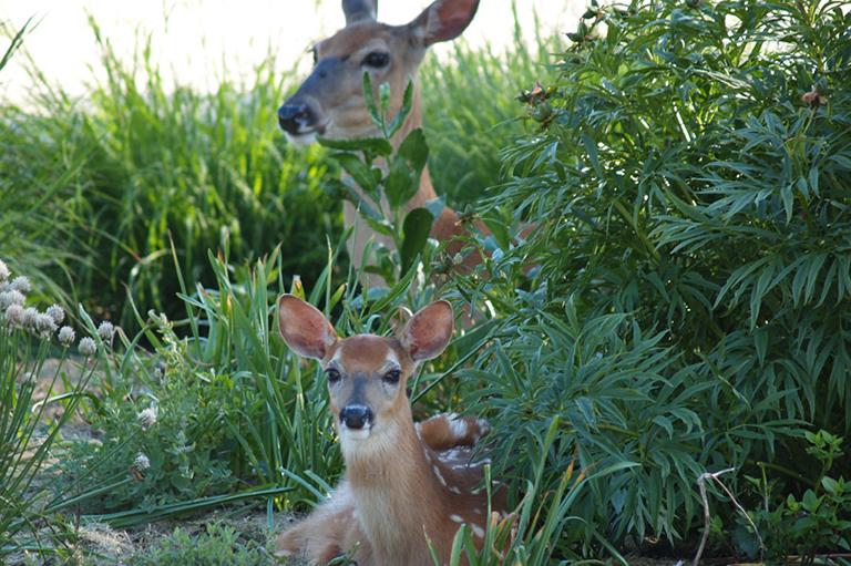
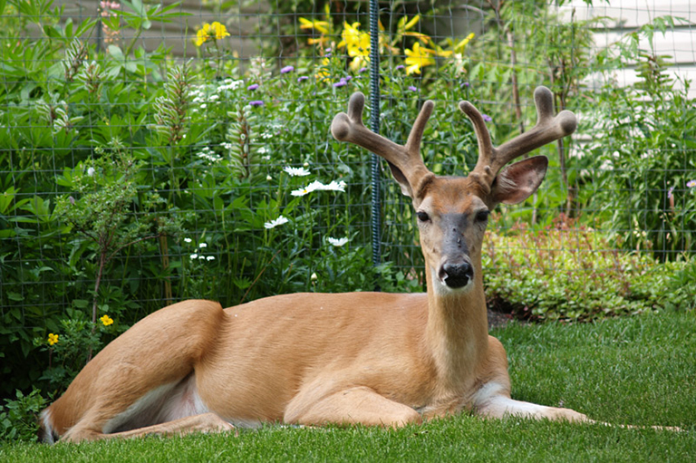
Several deer graze on the boulevard, unperturbed by the arrival of visitors.
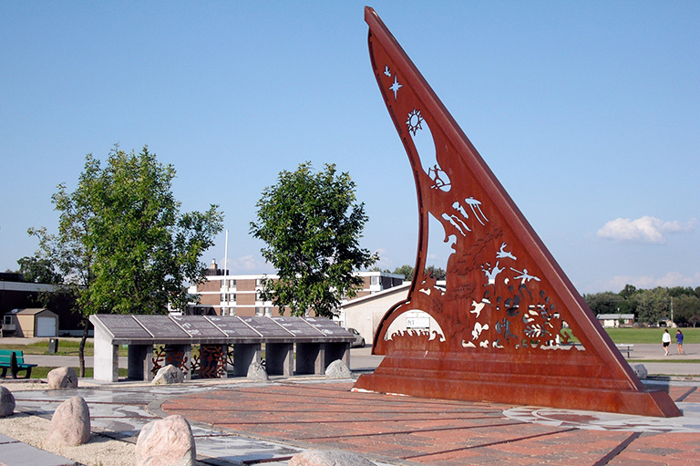
At the end of this road is a large metal structure, the Pinawa Heritage Sundial. Built as a Millennium Project, the massive timepiece incorporates twelve heritage themes, including the First Peoples, La Vérendrye, and hydroelectric power.
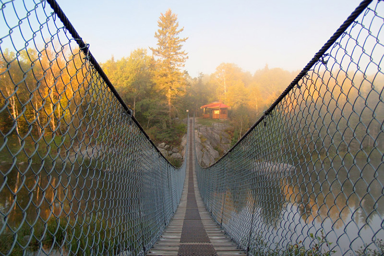
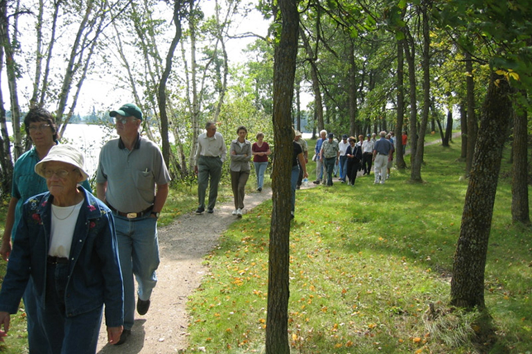
The town’s marina gives the area a seaside feel, and people walk along the well-used Ironwood Trail (named after a stand of rare ironwood trees) that winds along the Winnipeg River. From the trail you can view two islands: French and Furey.
These were named after two soldiers of the Winnipeg Grenadiers who died during World War II.
There is so much more to see and enjoy here and in other areas of the Whiteshell region — petroforms, monuments, museums, and a goose sanctuary await us. But that will have to be another getaway.
Advertisement

Canada’s History Archive, featuring The Beaver, is now available for your browsing and searching pleasure!
Help support history teachers across Canada!
By donating your unused Aeroplan points to Canada’s History Society, you help us provide teachers with crucial resources by offsetting the cost of running our education and awards programs.