Your history. Your inbox.
7 uniquely curated newsletters to choose from.

The misty mountain air is deceiving. Looking back, you can’t check if anyone is catching up to you. Looking ahead, you can’t see how far you have left to climb. Plus, you can’t tell what time of day it is — it could be 1:00 a.m., it could be 1:00 p.m. — and therefore you have no indication of how long ago you started your day.
But none of that matters.
While on a major trek like the Chilkoot Trail, which runs fifty-three kilometres from Dyea, Alaska, to Bennett, B.C., you’re reminded to stay in the moment. The time of day, how long something will take, and socializing with others aren’t priorities. Instead, you have only one task for the entire day: to hike.
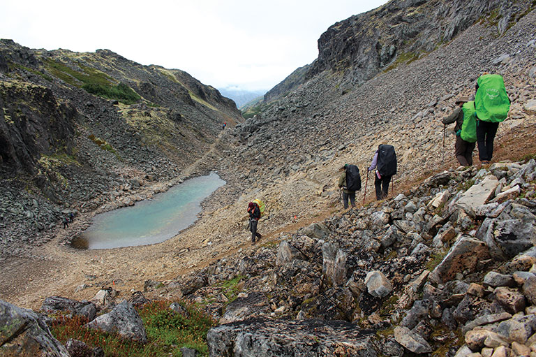
Or to climb while on the “golden stairs,” which lead you to the summit of the trail. Less stairs and more like giant loose boulders, the golden stairs — only two kilometres long, yet perhaps the most difficult part of the hike — are both physically challenging and a mental test.
As I crawled up the path, I would place my hand on a rock, about to pull myself up, and it would come crashing down, starting a waterfall effect with the scree next to it and forcing me to choose a new route.
The Tlingit (Indigenous people of the Pacific Northwest) used the Chilkoot Trail as one of five trade routes to the inland, where they traded goods with interior First Nations and, later, with European and American traders. In the late 1890s, Klondike prospectors used the Chilkoot to make their way to the heart of the gold rush in Dawson City, Yukon, contracting many Tlingit — who knew the area well — to move their gear.
As I hiked along with a fourteen-kilogram pack on my back, I thought about the gold rush prospectors who once carried between twenty-two and thirty-six kilograms along this same route — multiple times.
Waiting for them at the summit were the North West Mounted Police, who would only allow prospectors to cross into Canada if they had enough supplies to survive a year. About 521 kilograms of food per person was required. This meant prospectors made multiple trips, hired local packers, and used tramways to transport all necessary gear.
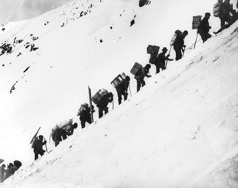
Prospectors, and their packers, risked their lives for good fortune, and many didn’t survive. The single deadliest event of the Klondike Gold Rush happened on the Chilkoot Trail. On April 3, 1898, an avalanche occurred, and about sixty-five people died.
Though the Tlingit knew the path and potential risks well, as the route became more popular with gold rushers, fewer Tlingit worked along the trail, meaning local knowledge of the trail was lost.
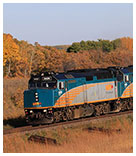
Seeking a sense of personal accomplishment, rather than gold, I hiked the Chilkoot with five others from July 28 to July 31 of 2019. We started the hike in the ghost town of Dyea, Alaska, and ended in Bennett, B.C., where we caught a train to take us back to Skagway, thirty minutes from Dyea.
From the trailhead, the path goes straight up, a good indicator of what is ahead — the hike is difficult, and though some people will say, “It gets easier,” it’s best not to get into that mindset –– because it doesn’t really get easier, especially as your body becomes more and more exhausted.
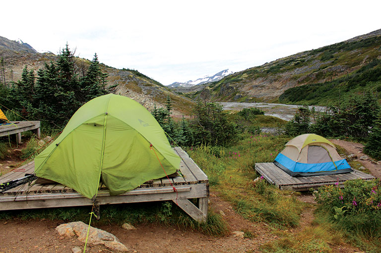
The first day we hiked 20.9 kilometres, staying overnight at Sheep Camp. The second day we hiked 12.1 kilometres to Happy Camp. The third day we hiked 13.7 kilometres to Bare Loon Lake, and on the fourth day 6.4 kilometres to Bennett, the end of the trail.
There are eight campsite options on the trail, plus one at the end in Bennett. At each campground are designated tent platforms, which are located away from the bear-proof bins where you must keep all food, cooking tools, and toiletries.
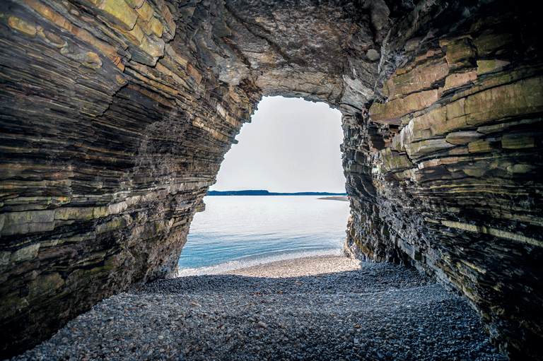
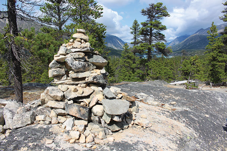
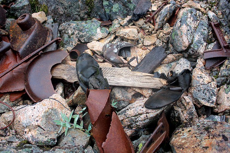
The trail is a living museum with gold rush artifacts lining the way. You’ll see century-old shoes, cables, and transport infrastructure, like boat and tram ruins. Plus, the landscape constantly changes — from rainforest, to mountain range, to desert — introducing you to different flora along the way.
It’s hard to imagine that points along this trail were once bustling spots. During the gold rush prospectors set up camps that eventually grew into small settlements. For example, Sheep Camp, where along with twenty to forty other hikers, we set up our tents and gathered in the communal cooking area to make small talk, was once filled with restaurants, hotels, doctor’s offices, saloons, and dance halls.
It’s also hard to imagine completing this hike without modern conveniences — hiking boots for water, snow, and sand — ibuprofen for your sore muscles, and the option to hike the trail for pleasure, rather than for necessity.
At Canada’s History, we highlight our nation’s past by telling stories that illuminate the people, places, and events that unite us as Canadians, while understanding that diverse past experiences can shape multiple perceptions of our history.
Canada’s History is a registered charity. Generous contributions from readers like you help us explore and celebrate Canada’s diverse stories and make them accessible to all through our free online content.
Please donate to Canada’s History today. Thank you!
Advertisement
Canada’s History and its partners offer unique, history-based tours at home and abroad throughout the year.
Help support history teachers across Canada!
By donating your unused Aeroplan points to Canada’s History Society, you help us provide teachers with crucial resources by offsetting the cost of running our education and awards programs.