Your history. Your inbox.
7 uniquely curated newsletters to choose from.

Find coal, William Logan was told. Like oil today, in 1843 coal was essential to economic development. But Logan found no coal in the Province of Canada. Undaunted, he continued his pioneering work for the fledgling Geological Survey of Canada. What he discovered soon brought him honours and fame. And proved to the world that Canada was a treasure trove of mineral wealth.
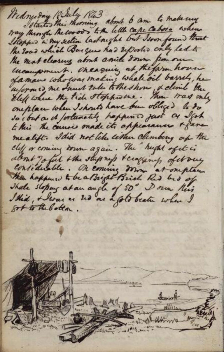
Mid-July, 1843: a mild summer evening in eastern Quebec, at a campsite a few kilometres upriver from the town of Gaspé. On the peninsula of the same name. Near the fire, a Micmac scrubs away industriously at the cooking gear and calls out something to the older-looking white man emerging from the tent. Roughly dressed, this man has an air of contentment that is broken only for a moment as he digests what he has just been told. A brief frown, followed by a quick laugh, and he disappears hack into the tent to note this latest development in his journal:
While Basque [the Micmac] was preparing the flying pan In hailing some water in it to get the rust off, he said we were in want of a dish cloth. Such is forgotten. ... But the want of a dish cloth puts me in mind that we have no towels, and the want of towels reminds me that we have no soap. Shaving will therefore be out of the question for some time. Of course we shall wash our faces even morning but it must he with water alone, and our handkerchiefs must dry them. A man must have his thoughts about him when he takes to house keeping in the woods.
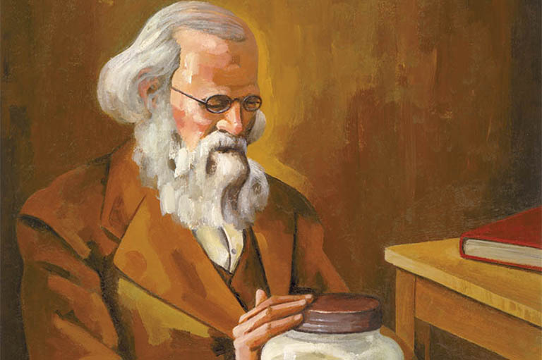
The author of this journal is no experienced woodsman. In fact, at forty-five, he is spending his very first night in the hush. His simple appearance and unassuming manner belie his roots in British business and scientific circles: he is well-regarded by his peers, the learned gentlemen of London. No mere dilettante, this man is on a profound personal mission to bring a higher level of science to Canada than it has ever known before.
For his efforts, he will one day receive international honours and he knighted by Queen Victoria herself. But all this lies more than ten years in the future: tonight, he is only an ex-manager of a Welsh copper works, returning to his native country to make a new career for himself, who has just realized that he is not fully prepared for life in the Canadian wilderness. His name is William Edmond Logan. He is the newly appointed director of the Geological Survey of Canada, and his mission starts here, now in Gaspé.
Although the Province of Canada was young and relatively undeveloped. It is not surprising that the Legislative Assemble was willing to grant a modest sum (£1,500) in 1841 to have a geological survey carried out. In most of the American stales, similar endeavours had recently been completed. Or were still in progress, as was the case in Great Britain.
Supporters confidently expected that the costs of such investigations would he repaid many times over by the value of the mineral resources discovered. If not for the political uncertainty of the later 1830s. Upper Canada probably would have had a geological survey even sooner. As it was. the proposal for a scientific exploration of the newly united colonies of Canada West and Canada East represented an important step forward in the wake of the Rebellions of 1837–38.
In this light, Canadian politicians agreed to support a geological survey of their territory and anticipated great results.
In an age of railroads (though they had not yet been built in Canada) and steamship travel, coal was the most highly sought-after geological commodity. Britain’s industrial supremacy was founded upon coal, and the new transatlantic steamers shortened the distance between Liverpool and Halifax remarkably.
Huge coal deposits existed in northern England and in South Wales and were seen by the theologically inclined, like Oxford geologist Reverend William Buckland, as proof that God had designed the Earth’s strata for the future benefit of mankind, and of British peoples especially’. The U.S. also had massive coal reserves in Pennsylvania, and even the sister British North American colony of Nova Scotia was home to workable beds of coal.
So where was the coal in Canada? No question would press harder on the person chosen as the new provincial geologist.
History is replete with striking coincidences, and one of these was the availability of just the right person for this job at just the right time. William E. Logan was a skilled geologist with experience in surveying and mapping. His previous work in South Wales had already been gratefully adopted by the British Geological Survey. And Logan’s particular area of expertise was coal formations.
Not only had he mapped the coal fields around his home in Swansea with unparalleled precision, he had developed his own theory of the origin of coal deposits and presented it to the prestigious Geological Society of London. Alter leaving the copper works in 1838, Logan undertook a lour of eastern North America, visiting the coal fields of Pennsylvania and Nova Scotia in 1840–41. And last, but certainly not least, unlike any other conceivable candidate for the job. Logan had been born in Canada, in 1798.
Although the Logan family had returned to Scotland from Montreal when William was seventeen and a student in Edinburgh, his status as a Canadian exercised a firm grip on the public imagination throughout his career in Canada.
With his local origin, his impeccable qualifications, and enthusiastic testimonials from leading British geologists. Logan had no trouble obtaining the appointment in 1842. It might have seemed like his appearance on the scene was no less providential than the Creator’s provision of mineral resources. But just because Logan was an easy choice to lead the Geological Survey of Canada did not mean that the work of conducting the survey would be easy.
Canada’s geology had been scarcely explored in the preceding years, mostly by British military officers with only basic scientific training. Moreover, the existing topographical maps, if any, were usually inadequate. In Britain, geological surveying consisted of adding geological observations to highly detailed base maps — this is what Logan had done in South Wales.
In 1843, Logan chose to begin his survey on the Gaspé peninsula for several reasons. It was the eastern-most point in Canada south of the St. Lawrence, and the closest to New Brunswick, the farthest-known extent of carboniferous (coal-bearing) rock formations. In short, it was the best chance to find coal in Canada.
To do this, Logan would have to determine the correct relationship of the Gaspé rocks to those of true coal-bearing age. And to do this, he had to apply high scientific standards to his work in the field to ensure the accuracy and reliability of his results.
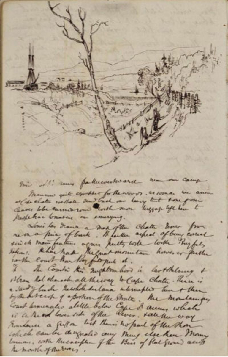
Following Captain Bayfield’s coastal charts, Logan spent the summer of 1843 working his way along the Gaspé shoreline between Cap-des-Rosiers and Paspébiac. Besides John Basque, the Micmac who had been hired locally. Logan was accompanied by John Stevens, the son of a New Brunswick mine owner. Logan hoped that their skills would make the difference in his efforts to apply his British experience to the Canadian environment. Of Stevens, he wrote:
Knowing something of mineral exploration, having a dash of the necessary enthusiasm, and being accustomed to rough it in the woods, able to handle an axe, manage a canoe, and fit up a camp, as they call it, I anticipate with his assistance, and that of the Indian, getting along with economy and despatch.
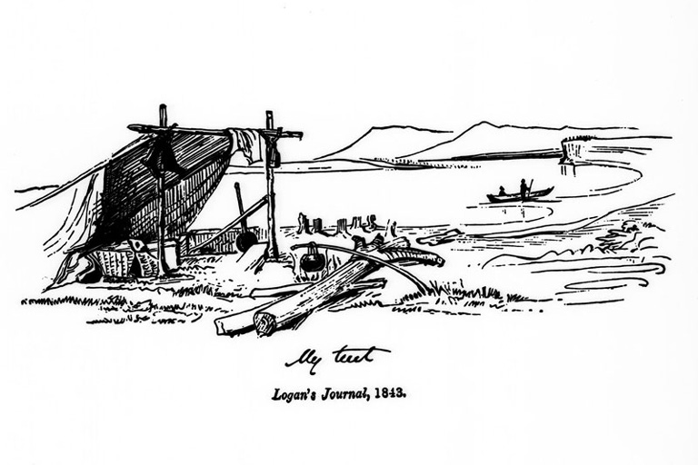
It turned out that Basque’s knowledge and abilities were the more critical of the two. On one occasion the expedition parly stayed at his summer wigwam, along with Basque’s extended family. Logan noted the details of the construction of this residence with the same keen eye that he applied to all his observations of novel phenomena. More importantly, Basque knew which local plants and animals were good for eating and how to prepare them.
Porcupine (“rather better than suckling pig”) soon became a camp favourite, especially when compared to the unpalatable supplies of salt pork and ship’s biscuit with which Logan had provisioned his expedition in a fit of British rigidity. Such behaviour was uncharacteristic of Logan, who was a man of simple tastes but who knew the value of a good meal. The party also frequently availed itself of fresh fish and lobster, readily obtained from the fishing people who made up the majority of European settlement on the peninsula.
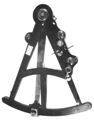
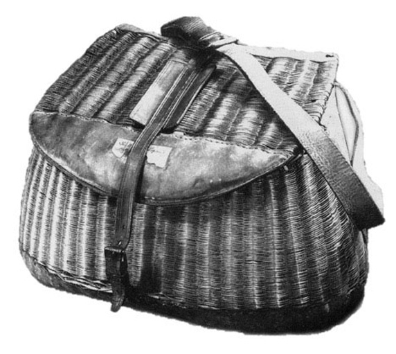
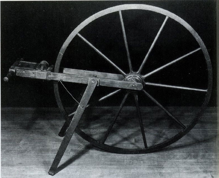
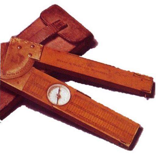
This rapid shift from imported to local foods is typical of the adaptations that Logan had to make when working in an unfamiliar environment. More crucial for his scientific results was the need to keep local conditions in mind when carrying out his surveying work. If lost or broken, Logan’s instruments could not easily be replaced or repaired.
Without instruments, he would not be able to determine the precise position, heading, and dip (slope) of the rocks he observed, and thus determine their age relative to known formations in neighbouring territories. In the first few weeks of his trip, Logan lost one of his surveying protractors, broke one of his prismatic compasses, and was forced to rely on his backup instruments.
Not all geological tools are complex. however — one of the simplest and most essential is the hammer, used to extract fossils from the surrounding rock. In Britain, during the 1830s. it had been definitively established that fossils were the single most important criterion in accurately dating a rock formation.
Paleontology was not Logan’s strong suit, however, so he was acutely aware of the need to bring back as complete a collection of Gaspé fossils as possible. After several months in the field, used to collect dozens of boxes of specimens, the party’s hammers were in serious need of repair. What Logan discovered, though, was that even the local blacksmith was often away from his post, “gone a-fishing.” Near Gascons, as autumn loomed.
Logan despaired at this dire situation, “surrounded by fossils without a hammer, I am like a stumped Bull in fly time. I can only point to the fossil spot. This will produce sad delay. The weather is so fine and may soon break up. I shall fret myself to death.”
Logan was quick to recognize those setbacks that threatened the integrity of his scientific enterprise. His response often tended to the dramatic. Not unlike our image of an absent-minded professor, his obsession with every minor detail sometimes prevented him from noticing more important things.
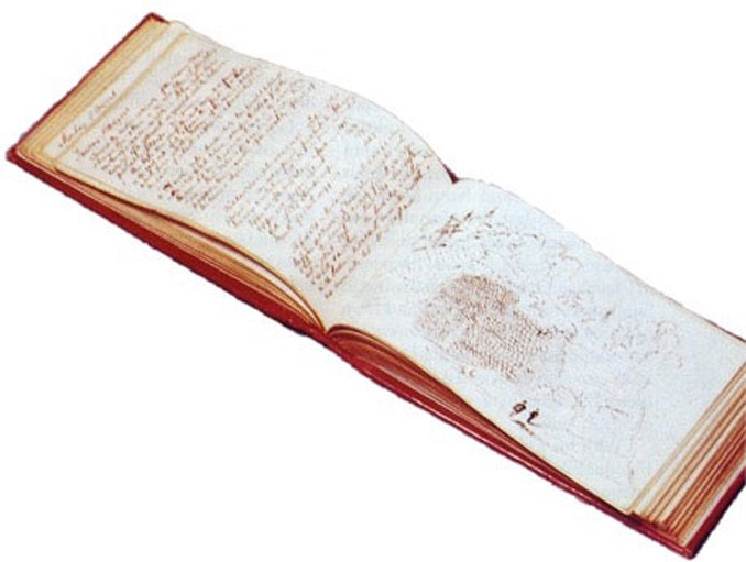
Logan had a terrible habit of losing his field notebook, in which all his measurements and observations were recorded. Nothing could have been more disastrous, of course, as his experience on Cap Gaspé (in today’s Forillon National Park) showed:
Again I have lost my hook and this time I have been obliged to return to the tent disconsolate without it. I shall put all hands to search for it tomorrow, for I shall die of a broken heart if it is not found. All the work I have done since I commenced is noted in it; and I shall be obliged to do it over again if the book is not recovered. A fortnight will thus be lost, and I doubt whether the work will be so well done the second time. Besides I shall get into disgrace for a supposed want of diligence, while God knows I have nearly done myself up with my exertions.
Luckily for Logan, John Basque’s eyes and instincts were sharp enough to pick the little red notebook out of the undergrowth the next clay.
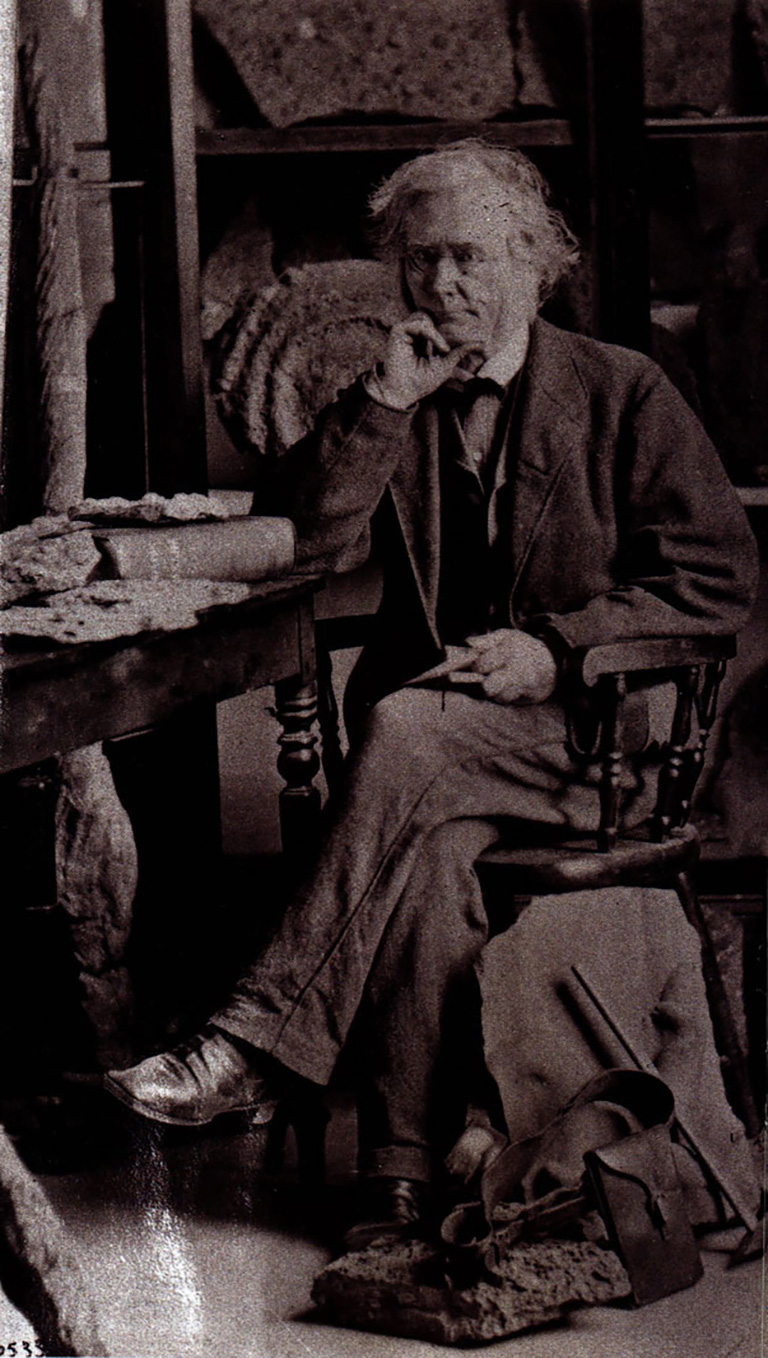
Logan’s lack of interest in mundane concerns was never expressed more clearly than in his public appearance. In both field and city, his attire was invariably utilitarian and frequently a very ragged version of that theme. As a result, his identity and purpose were often misunderstood by the Canadians with whom he came into contact.
Logan relished telling stories about being taken for a lunatic as he walked up and down the beach, counting his paces, peering through strange instruments, and hammering, seemingly randomly, at exposed rocks. The very fact that few could understand what Logan was doing seemed to prove the value of his work.
In truth, however, Logan depended greatly on local knowledge and local cooperation, just as he had in South Wales. Residents gave him directions, and there were always a few people with suggestions for interesting phenomena, like bituminous springs, to examine.
Logan spent some ten days in early September at Perce with Mr. Moriarty, an innkeeper, who toured him around the famous Perce Rock, arranged for him to ascend nearby Mount Anne, and lent him his whale-boat for a day trip to Bonaventure Island. Such instances of generosity are an important counterpoint to the idea that Logan encountered nothing but an inhospitable wilderness in Canada.
Nevertheless, dangers were always present. On a single day in August, Logan succumbed to more than his usual share of accidents.
I have had a blow on the head from a great stone weighing half a hundredweight, which fell upon me, fortunately from no great height. It has bruised my temporal muscle on the left side, and I can masticate only with great difficulty. John brought up soup about Jour in the afternoon. If he had brought anything that required the use of the jaws, I must have gone without dinner. I have had a tumble, too, on a slippery stone, striking my elbow; and I put my foot between two stones and pinched my instep, so that I am all bruises, and my limbs are as stiff as sticks.
The sheer physical challenge of undertaking a geological survey in Canada was certainly not the least of Logan’s worries.
The results of the 1843 field season were not encouraging. All evidence indicated that coal did not exist in the Province of Canada, and indeed could not. The rocks of Gaspé, the youngest of the Canadian formations, were still far too old to belong to the Carboniferous Period.
Geological experience firmly denied that coal could ever be found below the carboniferous, despite the fervent belief of many Canadians to the contrary. They saw no reason why their province should he bound merely by what had been observed elsewhere. Yet finding coal was exactly what Logan had been hired to do.
Logan was politically astute. Rather than declare his negative results unequivocally, he tried to deflect attention for another year. His first annual report, for 1843, said almost nothing about his actual fieldwork in Canada. After two years, however, Logan had spent £800 of his own money over and above the survey’s appropriation, despite having explored very little of the colony. Convinced that the Geological Survey had great potential and would eventually be appreciated, Logan went back to the legislative assembly for a further five years of funding, promising in return to report more fully on his progress.
It was clear that he needed a dramatic way to convince Canadians that their geology was worth further investigation. Logan’s opportunity came in 1851 with the Great Industrial Exhibition held at the Crystal Palace in London. England.
For this show, the first of its kind, Logan assembled a diverse and ingenious collection of Canadian rocks and minerals, showing the range of economic activity the province could support. Widely acclaimed, Logan’s exhibit earned him a fellowship of the Royal Society of London, and would have won medals had he not also been a juror in his class.
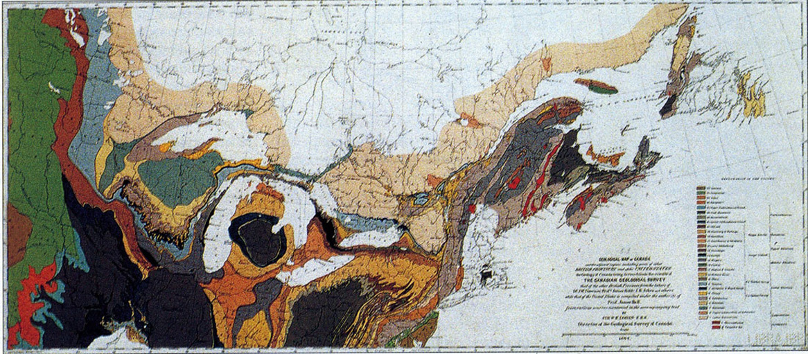
Four years later, at the Paris International Exposition of 1855, a sequel display and an accompanying geological map of Canada yielded a gold medal, membership in France’s Legion of Honour. The highest award of the Geological Society of London, and at long last the title of Sir William.
In 1863, Logan led an ever-expanding Geological Survey of Canada to the publication of its major monograph, the 983-page Geology of Canada, which summarized all the work up to that point. It was accompanied by an atlas. In 1869 the long-awaited large-scale (twenty-five miles to the inch) geological map of Canada and northeastern North America was released.
Confederation had radically expanded the meaning of “Canada,” and thus the survey’s mandate, but this was a task for the next generation. At the age of seventy-one, Logan could finally retire, his own mission complete. He lived another six years before his death in Wales in 1875.
As its founding director, William Edmond Logan was responsible for the Geological Survey of Canada’s visible triumphs. But it should not be forgotten that the great publications, exhibits, and maps of the later years were the fruits of long labours in the field. The basic activities of exploration identification, and classification provided the material from which Canadian geology would be built.
Year after year, inching across the surface of the country, Logan and his assistants brought scientific order to the wilderness. Their work made it possible for Canadians to see their land in new ways. Geology might be the science of the past, but catalogues of economic minerals pointed only to a prosperous industrial future. Ultimately, everything the survey accomplished went back to Logan’s first experiences in the Canadian bush and along the Gaspé coast, where he determined that this provinces geology could and would be subject to scientific analysis.
Drawing on his experience in South Wales, Logan combined British surveying methods with local knowledge. He succeeded in his goal of bringing the science of geology to Canada, even though it meant dashing the hopes of his patrons, who had hired him to find coal. Given the importance of mineral resources to Canada’s later development, though, it’s hard to think that they made a mistake.
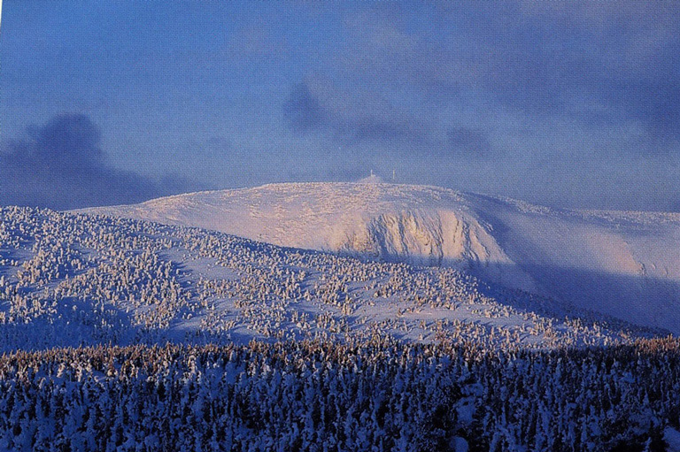
Epilogue, mid-July, 1844: Gaspé again, almost exactly one year later. Logan has brought a much larger surveying party this time, with two scientific assistants, five natives, and three canoes. Today, though, there is no tranquil repose before a reassuring fire. Instead, they are more than a kilometre up in the sky on bare rock beyond the tree line, bulleted by constant winds and enduring temperatures hardly above freezing. It has taken three days of trying just to get to this summit, the highest one they can reach. Instead of merely skirting the coast, Logan has deter-mined this year to explore the unknown interior of the peninsula. Now, the party is high up in the Chic Choc mountain range that separates the St. Lawrence from the Bay of Chaleur. No white man has ever crossed these peaks, and the present explorers too would turn back if not for their native guides, porters, and boatmen. (And even then, one does.) The surveyors have reached this point by canoeing up the Cap-Chat River, in vessels now abandoned. To continue onwards they will have to build new canoes to descend the Cascapédia River on the other side.
First, though, their work on the summit has to be completed. There are sixty-three other peaks visible, and the compass bearing to each one needs to be recorded carefully. Below, they can see the great St. Lawrence spread out, the boats upon it merely dots at this distance.
They raise the Union Jack in hopes of being spotted by the mail steamer as it passes. In his understated Scottish fashion, Logan reflects on the advantages of nasty weather: “I drew a panorama of about one-half of the circle of hills, and hope to finish to-morrow. ... Drawing with a temperature of 43°[F], and a strong wind blowing, is anything but warming for the fingers. We had scarcely a black fly the whole day— thanks to the wind."
And while their leader sketches and muses, John Stevens and assistant geologist Alexander Murray discuss their plan to name this peak Mount Logan.
Years later, of course, there will be another Mount Logan, in the far northwestern corner of Canada, in a land never seen by Sir William. Much higher than its predecessor and much better known today, it serves as a memorial of the ultimate outcome of the survey’s work: a nation large and proud. But the Mount Logan in Quebec, though not even the highest hill in Gaspé, seems in a way no less significant.
For this is a summit upon which he actually stood, a testament to his physical accomplishment in performing a geological survey of Canada. Scarcely a year after he began, William Logan was no longer a bemused neophyte.
On top of this peak, proclaiming his scientific authority over lands that stretched as far as the eye could see, he was truly a pioneer of Canadian science in the bush.
Advertisement
Canada’s History Archive, featuring The Beaver, is now available for your browsing and searching pleasure!