Your history. Your inbox.
7 uniquely curated newsletters to choose from.


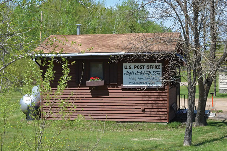
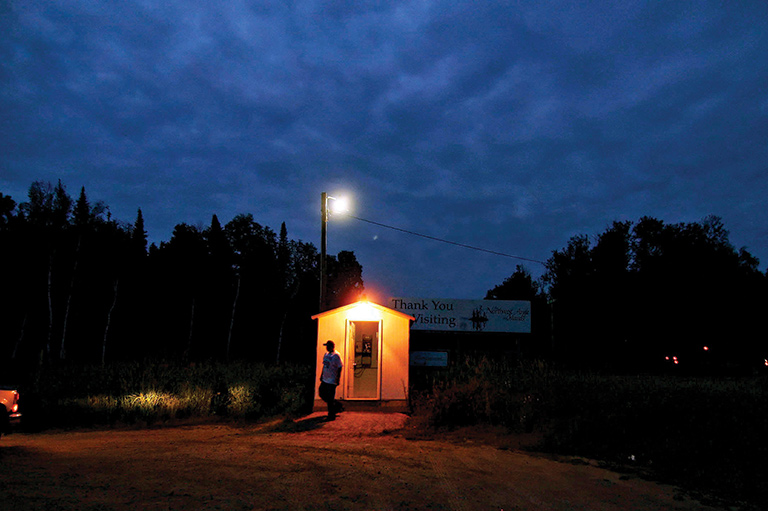
The Canada-United States border is the world’s longest and most stable international boundary, but it is not without its irregularities. One of those is the Northwest Angle: that small protuberance of Minnesota that sticks up into Lake of the Woods in northwestern Ontario — the most northern part of the United States until Alaska became a state in 1959. Why or how was this odd section of border even formed?
The Northwest Angle was part of the Treaty of Paris, signed in 1783, which ended the American War of Independence with Great Britain and established the United States. The treaty asserted that the boundary was to extend west from Lake Superior “through the Water Communication between it [Lake Superior] & the Lake of the Woods, to the said Lake of the Woods; Thence through the said Lake to the Northwestern Point thereof, and thence on a Due West course to the River Mississippi” and then south along the Mississippi.

With 7 uniquely curated newsletters to choose from, we have something for everyone.
The boundary of the United States was largely shaped by reliance on the 1755 John Mitchell map of North America, which was 30 years old at the time of the treaty negotiations and very inaccurate in its depiction of the continent’s western regions. Mitchell’s map incorrectly showed the Mississippi west of Lake of the Woods, and not until 1798 was David Thompson, then working for the North West Company, able to make a reasonably accurate identification of the source of the Mississippi as south and east of Lake of the Woods.
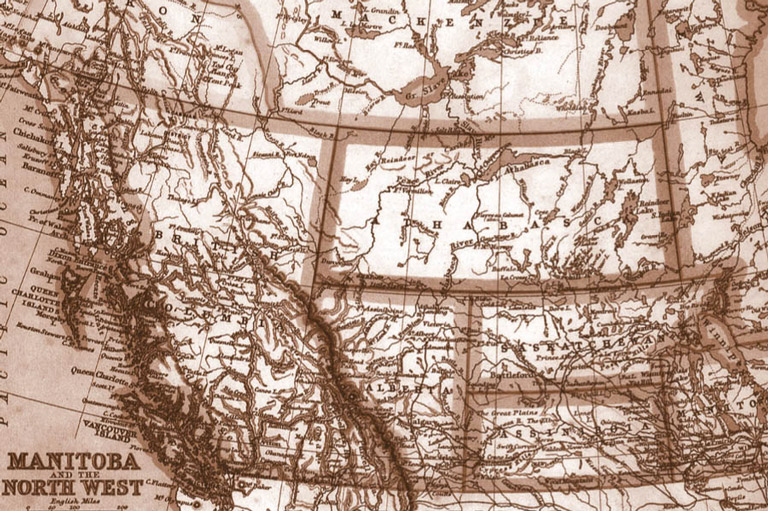
However, this “western” boundary wasn’t surveyed until the 1820s, by a Boundary Commission under provisions of the treaty ending the War of 1812. The source of the Mississippi River was by then recognized as south and east of Lake of the Woods. At that point, the United States had acquired the Louisiana Territory from France in 1803 and, in 1818, negotiated a treaty with Britain that defined the joint western boundary along the 49th parallel to the Rocky Mountains, while making provision for a north-south line to be drawn from the northwestern-most point of Lake of the Woods to that parallel. The problem then became identifying the northwestern-most point of the lake.
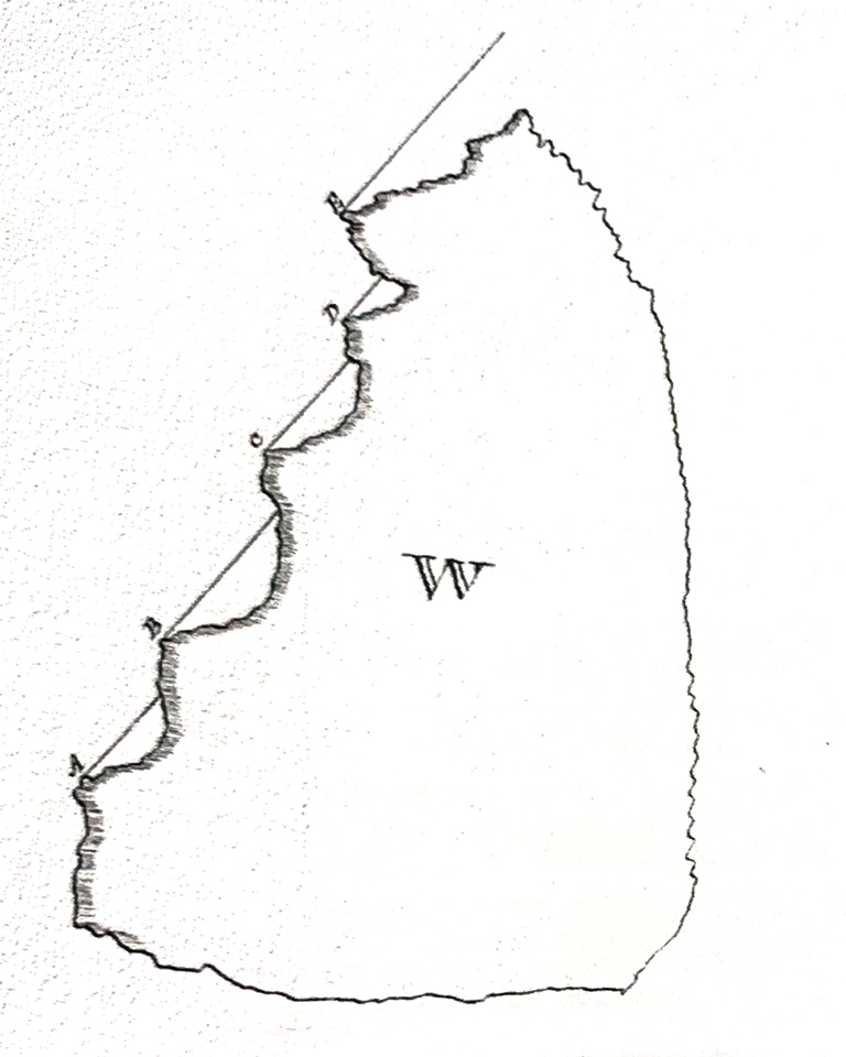
In the early 19th century, Lake of the Woods was still a major fur-trade route east from the Red River settlement through the Great Lakes to Montreal, even after the merger of the Hudson’s Bay Company and the North West Company in 1821. Although an important route, the lake had never been fully explored or surveyed. David Thompson’s survey for the Boundary Commission initially identified the northwest point of the lake at Rat Portage (present-day Kenora, Ont.) — the waterway to Lake Winnipeg — to which the American surveyors agreed. A line straight south from Rat Portage to the 49th parallel would extend the canoe route to the Rainy River in northwestern Ontario and east to the Great Lakes through U.S. territory, and therefore customs controls, and was thus an obstacle to fur-trade communications with Montreal.

When told by the Foreign Office of the possibility of Rat Portage as the north-westernmost point, Nicholas Garry, the deputy director of the Hudson’s Bay Company, who had traversed Lake of the Woods in 1821, objected strongly. Garry urged the Foreign Office to keep the border away from the water route. The Foreign Office engaged Johann Ludwig Tiarks, a German scientist who had earlier worked on the eastern boundary, to identify a less controversial point. Tiarks sailed for New York in 1825 and made his way to Lake of the Woods, where he re-surveyed several possible northwest points that Thompson had subsequently identified. Using the astronomical instruments he brought with him, Tiarks confirmed the finger of water, now known as Angle Inlet, as the north-westernmost point on the lake — several kilometres further west than Rat Portage.
Disagreements about other parts of the Lake Superior boundary prevented the Boundary Commission from settling the whole matter in 1827, but they did agree about Angle Inlet as the north-westernmost point on Lake of the Woods. When the Webster-Ashburton Treaty was signed in 1842, the Northwest Angle was confirmed as surveyed and agreed on in 1825 — thus the irregular “thumb” of U.S. territory sticking north into Lake of the Woods. The fur-trade route through Lake of the Woods and east to Montreal, meanwhile, was kept open for Canadian use.
Advertisement
We hope you’ll help us continue to share fascinating stories about Canada’s past by making a donation to Canada’s History Society today.
We highlight our nation’s diverse past by telling stories that illuminate the people, places, and events that unite us as Canadians, and by making those stories accessible to everyone through our free online content.
We are a registered charity that depends on contributions from readers like you to share inspiring and informative stories with students and citizens of all ages — award-winning stories written by Canada’s top historians, authors, journalists, and history enthusiasts.
Any amount helps, or better yet, start a monthly donation today. Your support makes all the difference. Thank you!