Your history. Your inbox.
7 uniquely curated newsletters to choose from.

European fur traders and explorers relied heavily on Aboriginal peoples for information about the land, water routes, and local resources of the regions they visited as well as for advice on the different cultures of the peoples they encountered. For example, explorer Peter Fidler used maps drawn for him by well-travelled Aboriginal peoples.
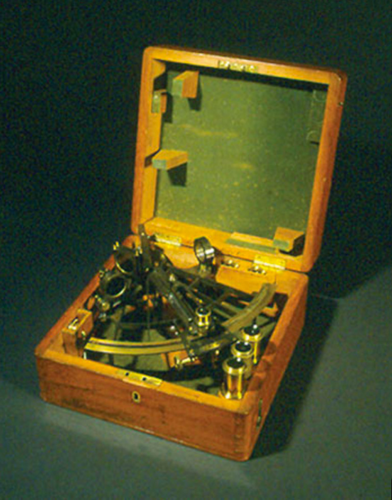
However, the Europeans also relied on surveying instruments to chart their journeys. One important instrument was the sextant. Sextants were used by navigators and surveyors and measured the angle between two objects. At sea, they were used to determine the angle between a celestial object — such as the sun, moon, planets, and stars —and the horizon. This measurement, known as the object’s altitude, was used to determine latitude and longitude.
This navigator’s sextant at the Manitoba Museum was created by Negretti & Zamba in London in the early 1860s. It sis in its original mahogany box containing an eyepiece, mirrors, a movable arm, and a measured scale. Written on the box is the inscription “Hudson’s Bay Company, May 3, 1864.”
Advertisement