Canada's History on your doorstep
Discover a wealth of interesting, entertaining and informative stories in each issue, delivered to you six times per year.

Discover a wealth of interesting, entertaining and informative stories in each issue, delivered to you six times per year.
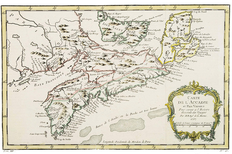
Sometimes it’s what a map doesn’t show that tells the tale.
In the late seventeenth and early eighteenth centuries, maps of Nova Scotia neglected to include the location of Pugwash, which today is a rustic fishing village of around seven hundred people located on the province’s north shore.
It’s possible that cartographers believed the settlement was simply not worth mentioning. Maybe it was an oversight. Or was it something else?
A local historian believes he has stumbled across a centuries-old secret that, if true, will require a rewriting of the history of French settlement in Atlantic Canada. In a new book, Stephen Leahey suggests that Pugwash was actually a major French port and a key link in a vital supply chain for Fortress Louisbourg on Île Royale (modern-day Cape Breton). He also argues that Pugwash’s omission was a deliberate act of obfuscation meant to hide the port from the prying eyes — and booming cannons — of enemy British forces in the region.
“When I began to look at the maps ... there was no Pugwash,” Leahey said. “It made no sense. There is evidence of massive amounts of cattle and grain produced [in the Isthmus of Chignecto between Nova Scotia and New Brunswick] and shipped to Louisbourg. But no other harbour on the north shore is fit to do that. Being aware that Pugwash has a deep harbour, it just seems very difficult to believe that the French would bypass the only deep harbour they had control of on the isthmus.”
The north shore of Nova Scotia is often a footnote in the larger histories of the British-French struggle for control of the region in the seventeenth and eighteenth centuries. At the time, the area was controlled by the French operating out of Quebec. Sparsely populated, it was also home to several Acadian and Mi’kmaq communities. The British, mean- while, were centred around the Bay of Fundy with Annapolis Royal as their capital. The construction of a French fortress at Louisbourg in the early 1700s further exacerbated tensions in the region between the two global powers.
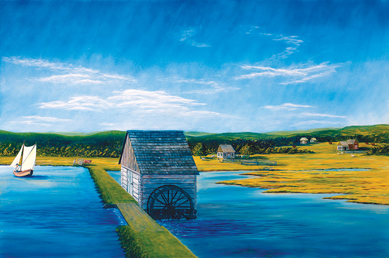
In his book Chignecto & Remsheg Prior to 1755, Leahey argues that, rather than having been a “backwater,” the north shore was actually home to a vital and thriving French port sometimes named in documents from the era as “Remsheg.” Via this port, the French shipped large amounts of grain and livestock to feed their garrison at Louisbourg. The deep harbour was also a safe haven for French warships.
Since the British had a history of attacking French ports in what is now Atlantic Canada, Leahey argues that the French had a good reason to leave Remsheg (today’s Pugwash) off their maps.
“The French preserved the secrecy of this port as they used it as a gathering point for Mi’kmaq, French, and naval forces in their struggle with the British,” Leahey writes.
Elsewhere in his book, Leahey highlights new historical and archaeological evidence that he hopes will inspire historians of Atlantic Canada to reconsider the French presence — and the north shore’s significance — in the larger story of the French settlement of Nova Scotia.
Leahey, who worked in corporate Canada as well as in the public sector in central and western Canada before retiring to Nova Scotia, is donating the proceeds from his book to the local Cumberland Museum Society.


Sign up for any of our newsletters and be eligible to win one of many book prizes available.