Canada's History on your doorstep
Discover a wealth of interesting, entertaining and informative stories in each issue, delivered to you six times per year.

Discover a wealth of interesting, entertaining and informative stories in each issue, delivered to you six times per year.
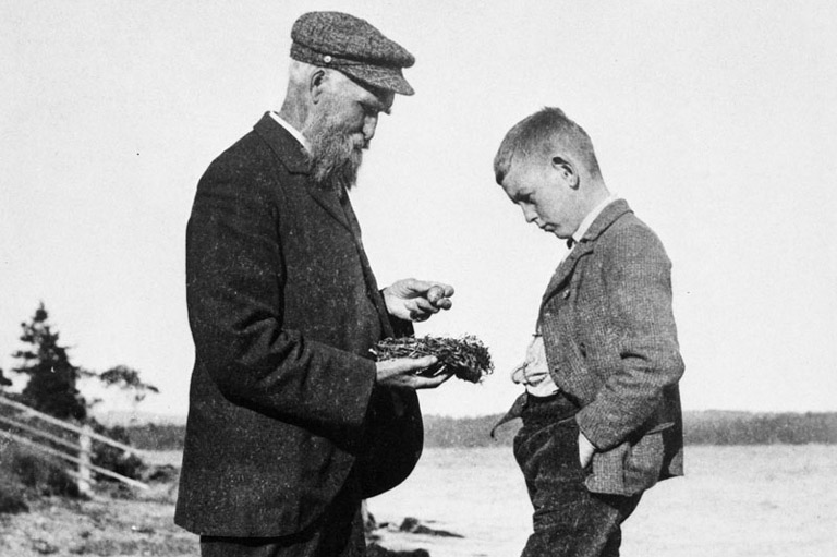
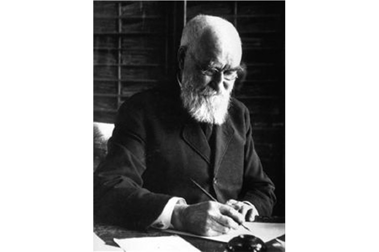
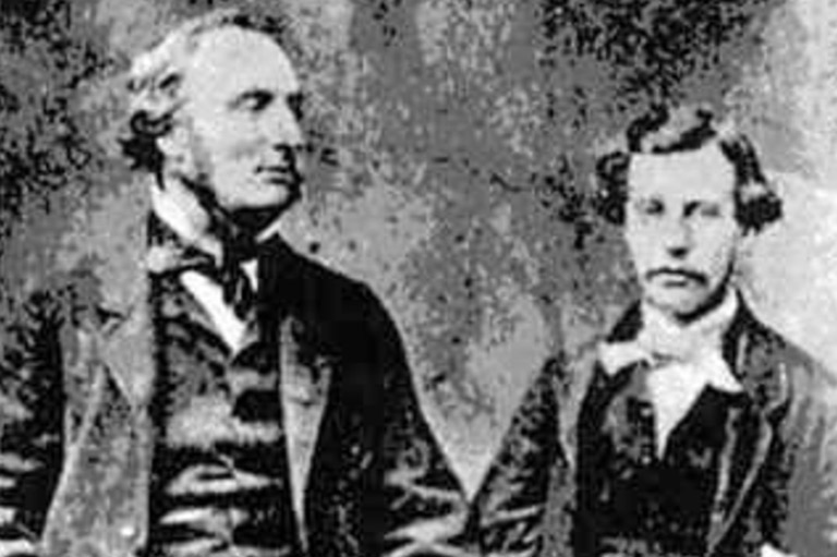
On July 15, 1872. John Macoun, a forty-one-year-old Irish-born botanist, was travelling to Lake Superior from Toronto by boat intending to study the plants of the Great Lakes region. By chance, he met Sandford Fleming, chief engineer of a proposed new railway from Montreal to the Pacific coast, who invited him to join his surveying party, which was travelling west across the North-West Territories and through British Columbia. Macoun — who, though self-taught, had become chair of the natural history department of Albert College, Belleville — would act as the party's botanist. The accidental meeting proved providential. Between 1872 and 1881, Macoun would take part in five surveys of western Canada under Fleming's aegis. His analysis of the prairie landscape and his enthusiasm for its potential would help shape the course of the railway and in doing so determine the shape of the country.
Through the summer of 1872, Macoun travelled from Bed River northwest to the Peace River district, noting plant life, soil conditions, and climate. At Oak Point on the east shore of Lake Manitoba, he saw in one day over four hundred different plant it species, a number and variety greater than that of Ontario and the Maritimes where the soil, he concluded, was similar. He travelled to Fort Ellice near the confluence of the Assiniboine and Qu'Appelle Rivers, just east of the present-day Manitoba-Saskatchewan border, over wet and muddy ground. It was “a perfect garden with rich soil and great numbers of autumn flowers,” he wrote. Then he proceeded through the Qu'Appelle Valley to the Touchwood Hills, about a hundred kilometres north of present-day' Regina. “Still we fell that there was no sign of want of fertility. All the land was good.”
Macoun travelled through an area two earlier surveyor-explorers, John Palliser and Henry Youle Hind. had termed the “fertile belt,” the outer rim of a triangle the base of which stretched along the forty-ninth parallel from Red River in the east to the Alberta foothills in the west and the apex of which was the Battle River watershed in northwestern Saskatchewan. A mix of trees and open spaces — sometimes called transitional parkland — the area bordering the outer rim was deemed suitable for agriculture. The inner body of the triangle, which was treeless grassland, was, according to Palliser and Hind, semi-arid — an extension of the Great American Desert to the south, and thus a barrier to cultivation and settlement. But Macoun, when his first prairie sojourn ended in September 1872, questioned his predecessors' conclusions. Was the fertile belt a narrow band or did it encompass all land between the North and South Saskatchewan, and possibly more?
It was not an academic question. By the 1870s, vital economic and political interests depended on the nature of Canada’s North-West Territories, which then encompassed all of what would become Saskatchewan and Alberta and most of the territory later assigned to Manitoba. It was a condition of British Columbia's entry into Confederation in 1871 that a transcontinental railway be started within two years and completed within ten. Settlement of the West, too, was part of governmental nation-building strategies of the day, and settlement would naturally follow a rail line wherever it was built. What route, then, would those rails take through this still largely unknown territory? For government and business, and for the settlers who would follow, the answer had enormous consequences. Fortunes could be lost and political careers ruined if the country was different than what it was expected to be.
Fifteen years before Macoun, John Palliser led the first scientific expedition into the interior of British North America. The Irish-born sportsman and gentleman explorer, who had become enamoured of the prairies after a nearly year-long hunting expedition in the Missouri country between 1847 and 1848, proposed a journey along the unsurveyed American border to the Royal Geographic Society. The society, however, expanded the proposal to include astronomy, zoology, botany, geology, paleontology, climatology, and geography, with funding from the British government, which needed information to decide the future of Hudson's Bay Company territories.
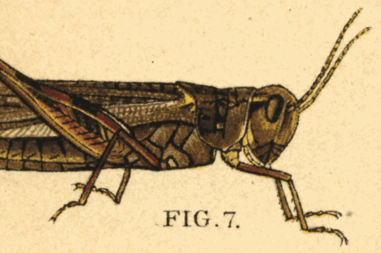
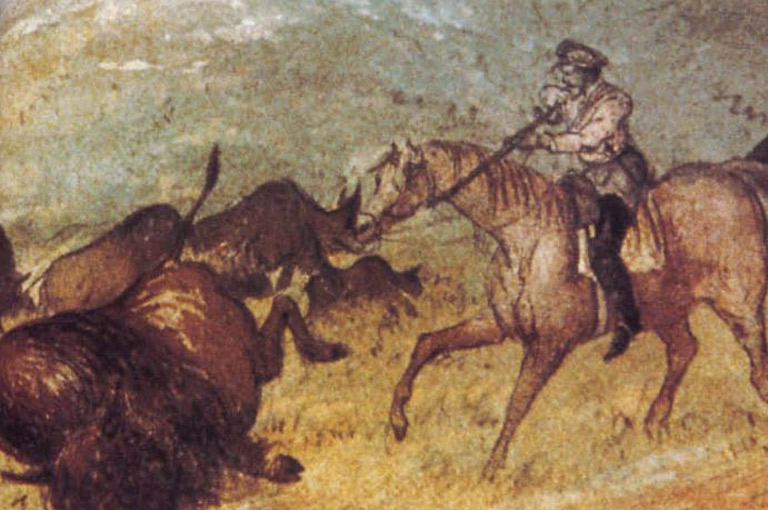
In May 1857, Palliser left England accompanied by such experts as botanist Eugène Bourgeau, geologist and naturalist James Hector, and mathematician and astronomer John Sullivan. Travelling through the U.S., the expedition arrived at the edge of the Great Plains, a vast sea of grass, in July. Within a month they had reached the Pembina River on what is today the Manitoba—North Dakota border. Most of the grass had been eaten by grasshoppers. By September, having pressed on through the southeast corner of present-day Saskatchewan to the Qu’Appelle Valley, they reached the Regina Plains. They saw a vast emptiness as far as the eye could see. Continuing northwest to the high banks of the South Saskatchewan River near the present-day town of Outlook, they continued to note dry and empty land. After overwintering at Fort Carlton, situated in parkland among grasses and aspen, they headed west over prairie stripped bare by fires and grazing buffalo. The summer of 1858 was spent exploring the prairie edge at the Rocky Mountains. Starting from Fort Edmonton, Palliser spent 1859 travelling the western portion of the territory that came to be named for him — Palliser's Triangle, the grasslands south of the parkland region. Good pasture and fresh water they could only find in the Hand Hills east of the Red Deer River, where Drumheller is today, before ending their odyssey in July in the oasis of the Cypress Hills.
After three years observing the climate and natural vegetation of midcontinental British North America, Palliser concluded that the grasslands were unfit for cultivation or settlement. In this he was supported by Henry Youle Hind, a professor of chemistry at Toronto's Trinity College, who in 1857 and 1858 similarly travelled the North-West Territories on a scientific expedition on behalf of the Canadian government (although Hind was more optimistic about the agricultural possibilities of the parkland region). Palliser's view became the prevailing orthodoxy.
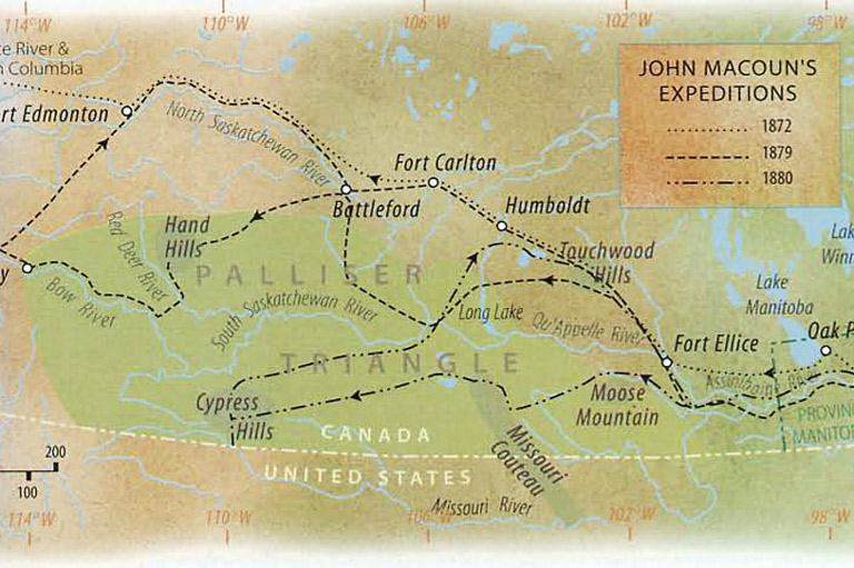
John Macoun made four more expeditions in the West, collecting plant and animal species widely and meticulously. With each trip he became more convinced that Palliser’s and Hind’s conclusions about the grasslands were pessimistic, and said so with great enthusiasm. However, he didn't visit the southern prairie until his third trip, in 1879, when he was assigned by the Conservative government (returned to power in 1878 after a five-year hiatus) to explore the district south of the Carlton trail between Winnipeg and Edmonton and north of the fifty-first parallel. Among his instructions was one to leave the Carlton Trail at the 102nd meridian and bear northwest for Long Lake (Last Mountain Lake), north of present-day Regina. The marker was where Palliser stated the “desert” began: the 300-kilometre distance to Long Lake was roughly parallel to one of the sides of Palliser's Triangle. Macoun was impressed with what he saw. “A most wonderful country full of flowers and copse-wood and small streams,” he wrote. At Long Lake he gathered cartloads of Lycoperdon — puffball mushrooms that thrive after heavy rains or during damp years. He ambled on, zigzagging through the grasslands of the western interior for the rest of the summer. After five months in the field he concluded that between the forty-ninth and fifty-seventh parallels at least 150 million acres of land could be put to the plough or used for raising livestock.
The next year he returned for a fourth expedition, this time taking in areas south of the Qu’Appelle and South Saskatchewan Rivers. All did not go well at first. From Moose Mountain to the Missouri Couteau to the Cypress Hills — approximately the breadth of modern Saskatchewan — he crossed dry, parched land. It was only when he found a homesteader growing an abundant crop of wheat and potatoes by the present-day Saskatchewan-Alberta border did he recover his usual optimism. In the same field were cacti and sagebrush. This 1880 expedition confirmed for him what he had concluded from his field work a year earlier: it was a matter of surface cover, not the climate, that gave the impression that the vast treeless prairie was unsuited to agriculture. In sum, he wrote: “We have ... a dry, clear, cold winter, a dry spring with bright sunshine; a warm summer with an abundance of rain. ... A dry serene autumn ... an atmosphere like this, with a soil of abounding fertility extending to a region on almost boundless extent.”

Sign up for any of our newsletters and be eligible to win one of many book prizes available.
In 1857 John Palliser looked over the Canadian plains and saw a desert. Through the 1870s John Macoun looked over the same landscape and saw Eden. What accounts for the difference in perception? The answer in large part lies with the type of weather each encountered. Macoun was lucky to be able to observe the prairies when it was experiencing the wettest decade in the nineteenth century. Palliser studied the landscape under normal-to-dry conditions. (And both extrapolated from too small a sample over too short a time.) Unknown to Macoun, continental North America in the late 1870s was experiencing particularly strong effects of El Nino, the warming of the cool Humboldt ocean current off the western coast of South America that occurs every four to twelve years. Milder, wetter weather on the prairies was the net result.
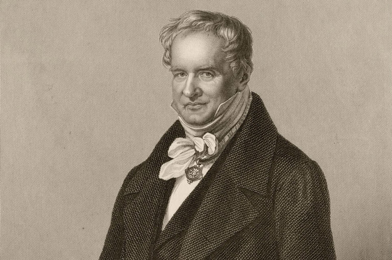
The Humboldt current was named for Alexander von Humboldt, a nineteenth-century Prussian nobleman and naturalist with a passionate interest in scientific exploration and with the money to finance it. Best known for his 1802 work on the oceanic current that bears his name, he also proposed the principle of continentality, which states that the interiors of continents have more extreme climates due to a lack of moderating influence from the ocean. Von Humboldt, a famous intellect of his day, was the first to consider nature in a geographic perspective. In his monumental 1845 work on physical geography, Cosmos, he outlined the relationship between climate and terrain and the range and distribution of plant and animal life. Macoun was a careful reader of Cosmos and it influenced his methods in the field. For instance, finding plant species thriving around Edmonton and along the Peace River that matched those growing in Ontario farming districts supported his conviction that the Canadian plains were well-suited to “the civilizing influence of the plough.”
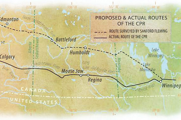
Macoun's optimistic assessment of the prairies' potential for agriculture and settlement, which virtually contradicted Palliser and Hind, dovetailed with Ottawa's own hopes for regional expansion. His findings became less the subject of dispassionate scientific debate and more the fodder of partisan politics. Some were skeptical: Alexander Mackenzie, Liberal prime minister from 1873 to 1878, judged Macoun's estimates overgenerous, and when he passed into Opposition was berated by Macoun from the visitors’ gallery of the House of Commons for attacking the government on the question of prairie soil. But the new Conservative government found in Macoun the ideal man to provide the agricultural rationale for its western strategy. To attract a private builder for the Pacific railway, the government planned to offer a large western land grant, which confirmation of fertile land would serve. On the basis of Macoun’s 1879 field studies, the government officially endorsed the Yellowhead route through the parklands of the northern prairies for the railway, which had been Sandford Fleming's recommendation through both Liberal and Conservative administrations. Macoun’s 1880 expedition banished any lingering doubts about the value of the prairie region. When the government passed into law the railway land grant in February 1881, after reaching an agreement with a private syndicate to build the Canadian Pacific Railway, the fertile belt (25 million acres of which the CPR received) was described as “land lying between parallels 49 and 57 degrees north latitude,” which incorporated all of the land Palliser had dismissed as arid.
In the spring of 1881, however, the syndicate abruptly decided to reroute the main line through the southern grasslands, the route we know today. Shortening the route was one of the reasons given. Another was eliminating competition from American-based railways who might send feeder lines into the southern prairie and siphon off business if the route ran too far north. But the impediment — that the land the rail line would pass through was almost desert — had vanished with Macoun's reports.
And thus was the mould and pattern of western Canada determined. If the route had followed Fleming's direction through the parkland region, places like Regina and Calgary would be negligible in size and importance, and hundreds of towns and villages that formed around the focus of the railway station would not exist. Settlement would have begun farther north and western Canada’s larger cities would have developed there.
In the summers of 1998, 1999, and 2000, plants, birds, and butterflies that had never been seen before in the dry south of Saskatchewan were identified and collected — big bluestem grass, usually found in Manitoba where there is more rain; morel mushrooms, a gourmet favourite, found normally in forests and the damp month of May; regal fritillary, an endangered butterfly of wet meadows and moist plains; and dickcissels, a prairie grass bird not seen in numbers for more than sixty years. An El Niño cycle that began in 1997 brought more rain to southern Saskatchewan than normal. If John Macoun had ventured into the area in those years, he would likely have come to conclusions similar to the ones he recorded in his reports to Ottawa in the 1870s.
If he had ventured into southern Saskatchewan in the 1930s, however, he might have agreed with Palliser that the grasslands were an extension of the Great American Desert. Even in the 1880s, the CPR tacitly discredited Macoun’s enthusiastic claims about the extent of arable land on the prairies by refusing to accept a significant portion of the land set aside for it in the seventy-seven-kilometre-wide swath along the railway route, and instead opting for substitute acreage in the Fertile Belt, the original corridor for the rails. In 1883, the dry cycle returned and lasted for a decade. Farms were abandoned and immigration declined. Ottawa, wondering about the future of the West, sent forth Macoun, now Dominion botanist with the Geological Survey' of Canada, one more time. As luck would have it, he arrived just as a wet cycle returned. Through the nineties and well into the turn of the twentieth century, the prairies would fill with immigrants, and the area would turn into the breadbasket of the world. Farming techniques imported from Ontario and Europe would be modified to accommodate prairie soil and climate. New plants would be introduced that could withstand the rigours of dry land. But then would come the dustbowl of the Great Depression.
Palliser’s and Macoun's observations about the climate and the land remain controversial. What will be the ultimate fate of the northern plains of North America? Climate change may play a role. So, too, may politics and economics — and sometimes they are even more fickle than the weather.
At Canada’s History, we highlight our nation’s past by telling stories that illuminate the people, places, and events that unite us as Canadians, while understanding that diverse past experiences can shape multiple perceptions of our history.
Canada’s History is a registered charity. Generous contributions from readers like you help us explore and celebrate Canada’s diverse stories and make them accessible to all through our free online content.
Please donate to Canada’s History today. Thank you!